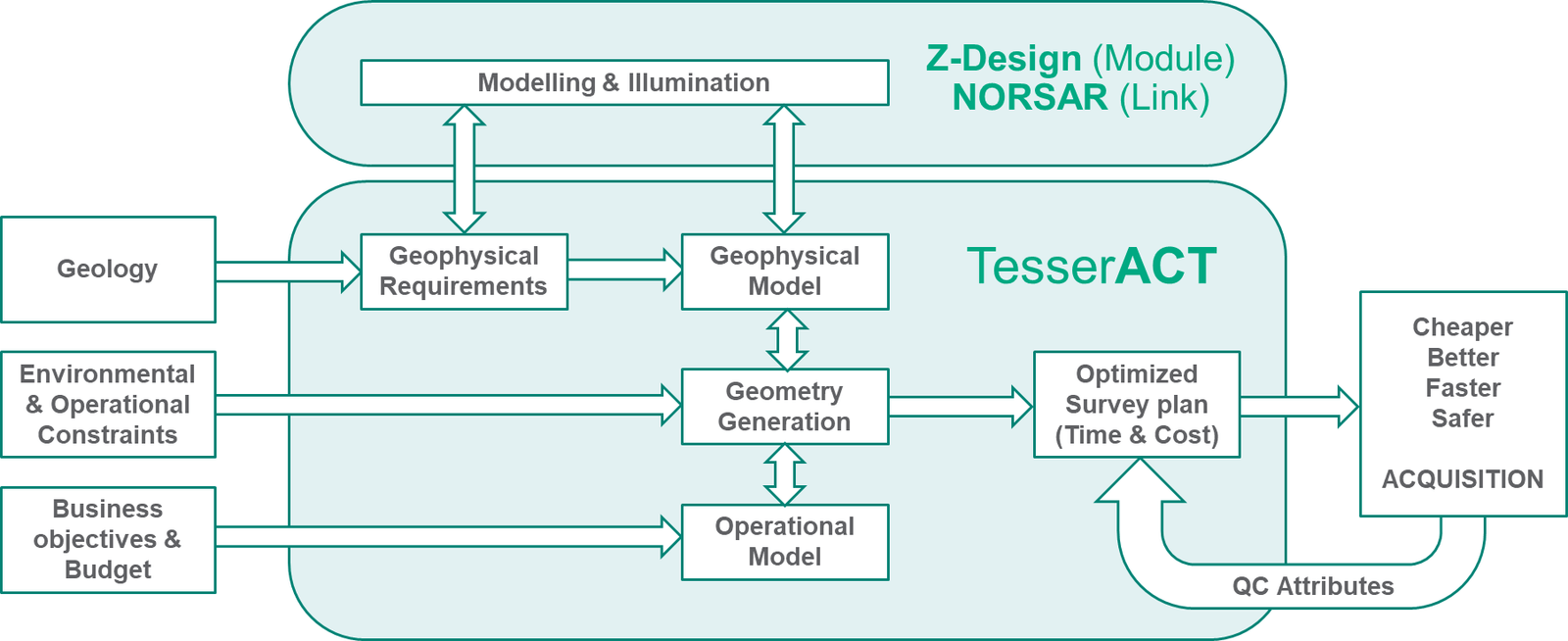
NORSAR Ray Tracing Link
TesserACT also provides a direct link for transferring complex survey designs into NORSAR 3D wavefront ray tracing workflows. Surveys created within TesserACT can be passed efficiently into NORSAR’s modelling environment without the need to export and manage relational geometry files, preserving survey complexity while streamlining the workflow.
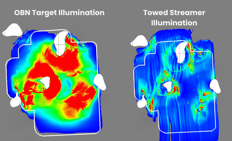
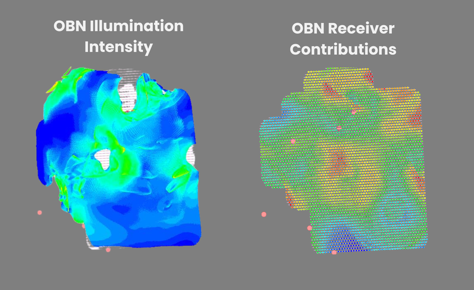
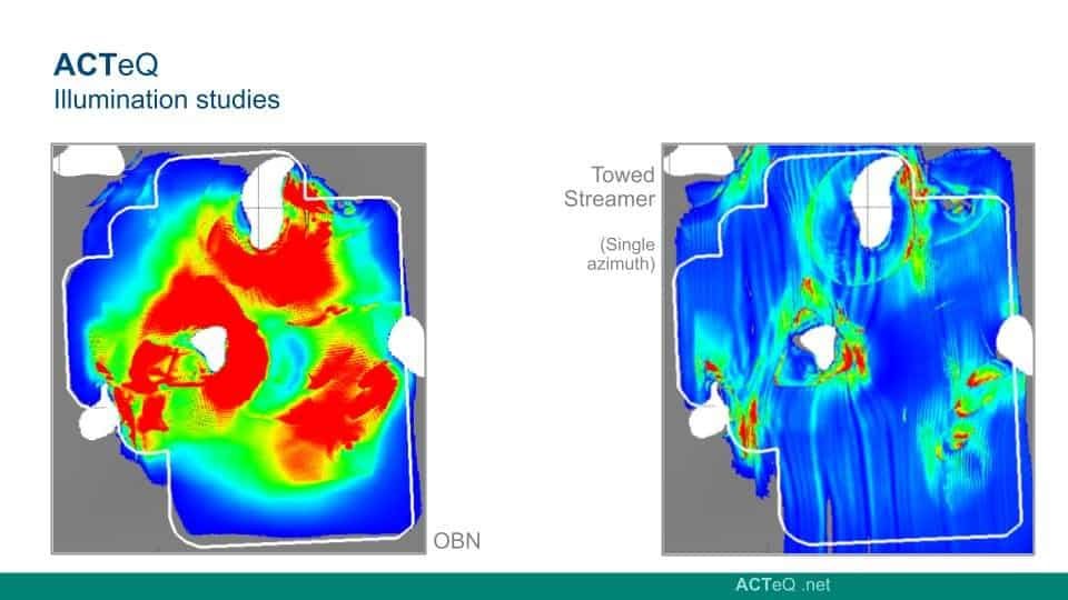
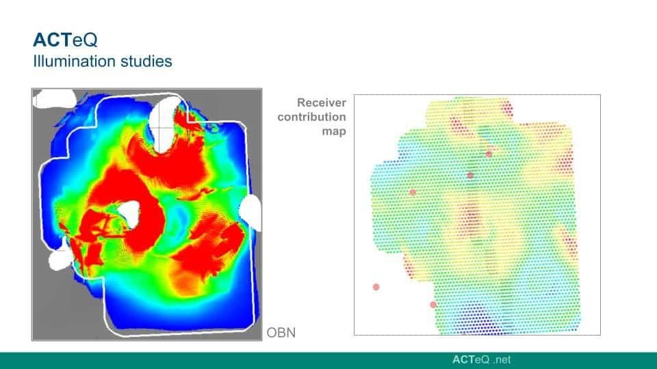
Once processed in NORSAR, modelling results can be returned to TesserACT as spatial mapping attributes describing illumination, ray coverage, and acquisition effectiveness across the survey area. These attributes can be loaded directly into the TesserACT environment, allowing geophysicists to visualize modelling results alongside their survey design and quickly identify areas of poor illumination, limited coverage, or complex subsurface interaction.
By incorporating these returned attributes into the design environment, TesserACT enables an iterative workflow where modelling insights can be used to efficiently update survey geometry, adjust acquisition parameters, and refine survey layouts. This tight integration helps ensure that acquisition plans are both technically robust and optimized for imaging the subsurface targets of interest.